
Chennai may see a break from rain as cyclone threat shifts north

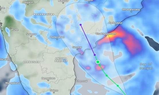
Chennai and its surrounding districts could experience a prolonged dry spell as a developing cyclone over the Bay of Bengal moves northwards, reducing the likelihood of significant rainfall across parts of Tamil Nadu.
According to weather officials, the system is forecast to intensify into a very severe cyclonic storm before crossing the coast between Bapatla and Visakhapatnam by the morning of October 28. The rain expected from Sunday night into Monday morning could be Chennai’s final substantial spell for the month.
While isolated showers remain possible in Chennai on Monday, Chengalpet and Kancheepuram may receive moderate rainfall. The Cauvery delta districts are also expected to see drier conditions from Tuesday.
V R Durai, head of the weather forecasting division at the Regional Meteorological Centre, said rainfall prospects across Tamil Nadu would remain limited until November 2. As the cyclone travels north, westerly winds are expected to bring predominantly dry conditions. Rainfall may return after the system weakens and easterly and northeasterly winds begin carrying moisture towards the region.
Weather blogger Pradeep John, meanwhile, indicated that Chennai and neighbouring districts could continue receiving showers through Sunday night, based on the prevailing wind pattern.
Despite the northeast monsoon’s onset on October 14, Chennai has experienced only one day of heavy rainfall, with intermittent showers helping keep temperatures below seasonal averages.
By 5.30pm on Sunday, Meenambakkam had recorded 1.2mm of rain, while Nungambakkam received 0.6mm. Coonoor led the state’s rainfall figures with 47mm, followed by Coimbatore at 44mm and Kodaikanal at 41mm. Maximum temperatures in Chennai remained below normal, reaching 28.1°C in Nungambakkam and 27.8°C in Meenambakkam.